Hello world!
Hello world!
June 6, 2017Welcome to WordPress. This is your first post. Edit or delete it, then start writing!
Diploma in Surveying
Associate member – Surveying & Spatial Sciences Institute
Construction Induction Card
Has worked alongside Tony periodically since 1985, as well as nine years based in Cairns and two years in Scotland and offers extensive experience in the construction industry to the Group. Tom specialises in site analysis and topographical surveys, building and engineering set outs, GPS surveys and machine control and works from a home office in Deans Marsh.
: 0417 551 446
: tomreid@swsg.com.au
: 305 Parkers Road, Deans Marsh, 3235
: 03 5236 3470
Bachelor of Applied Science (Surveying)
Licensed Surveyor
Institution of Surveyors Victoria
Established his surveying practice (Tony Jeavons Surveys) in Apollo Bay in 1984 and built a successful business which was sold in 2005 and practiced under the name Jeavons & Tomkinson until 2010. Tony brings over 30 years of professional experience working throughout the district consulting and managing land development projects. During this period he has developed a close working relationship with councils throughout South West Victoria. Tony continues to work from home offices in Apollo Bay and Jan Juc.
: 0430 401 954
: tonyjeavons@swsg.com.au
Saturday – Tuesday
: 14 Ocean Boulevard, Jan Juc, 3228
: 5261 2971
Wednesday – Friday
: 650 Wild Dog Road, Apollo Bay, 3233
: 5237 6409
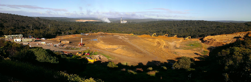
Anglesea Landfill October 2013
Setout gridlines, profiles (hurdles), building corners, hold down bolts and establish Temporary Benchmarks (TBM’s) for new residential, commercial & industrial developments.
Adopting the GNSS (GPS) system a network of control marks are established around the site. The design is converted to a digital terrain model (DTM) suitable for upload to the machine control system. We assist in calibration of the system ensuring that it is working correctly.
Volume computations of cut and fill for site requiring or undergoing excavation.
As constructed reports to Barwon Water standards if required of sewerage & water reticulation, earthworks etc.
Design & setout of farm dams, roads & drainage.
Location of underground services eg. drainage, sewerage, telecommunications, electricity, gas, water and buildings
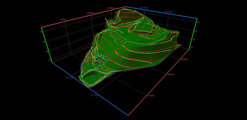
3d image Anglesea Landfill October 2013
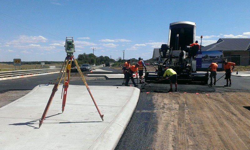
Resurfacing Works Point Lonsdale
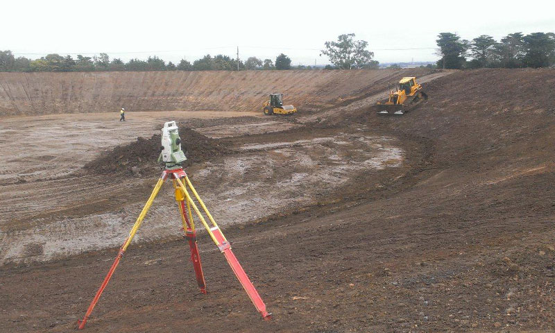
Lovely Banks Water Storage Basin 1

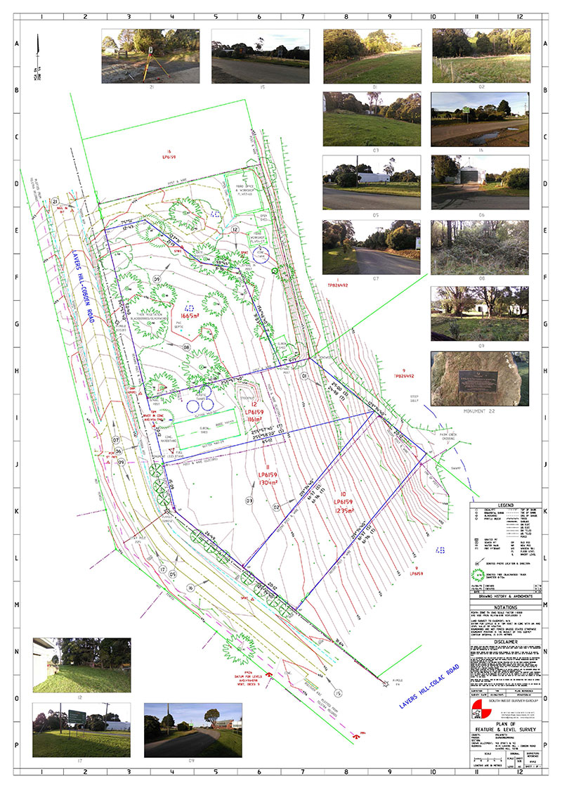
Feature & Level surveys to rescode specifications to support architectual, engineering and landscape design and large scale infrastructure projects.
Contour Plans
Control networks and digital terrain modelling over large areas including establishment of localization for machine control.
Remotely Piloted Aircraft Systems (RPAS) also known as drones or UAVs. RPA offer a product boost for data collection for aerial surveys, mapping, asset inspection and aerial photography.
Surveyors Registration Board of Victoria
Determines the location of the title relative to the existing occupation (fencing / buildings etc.) surrounding the site. Any issues regarding the title are also identified along with your rights to your title. This survey can avoid costly delays and any potential legal action from adjacent property owners. Marking the title boundary with pegs or other monuments and preparation and provision of a Plan of Re-establishment Survey. Lodgement of Plan with the Land Registry as per the Surveying (Cadastral Surveys) Regulations 2005 – Schedule 4, Regulation 16.
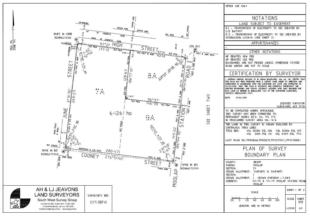
Subdivision of land from two lot subdivisions through to large multi stage estates. Includes preparation of Plan of Subdivision for , correspondence with the relevant authorities and
Subdivision of residential, commercial & industrial buildings.
Adverse Possession (Section 60, Transfer of Land Act 1958)
 2010_Your_guide_to_application_for_adverse_possession.pdf
(Section 99, Transfer of Land Act 1958)
(Section 103, Transfer of Land Act 1958)
The process of joining two titles together to form a complete parcel. A common process when a building is to be built over an existing boundary line.
Similar to the subdivision process in part, boundary realignment surveys do not create any new parcels but move existing boundaries. The process normally involves multiple property owners working together to achieve the desired result.
Create, vary or remove easements, leases or restrictions on land, subject to Council and Authorities approval.
Lease Plans computed for Gross Lettable Areas (GLA’s) and Net lettable Areas (NLA’s) of industrial warehouses or commercial offices using the Property Council of Australia Guidelines.
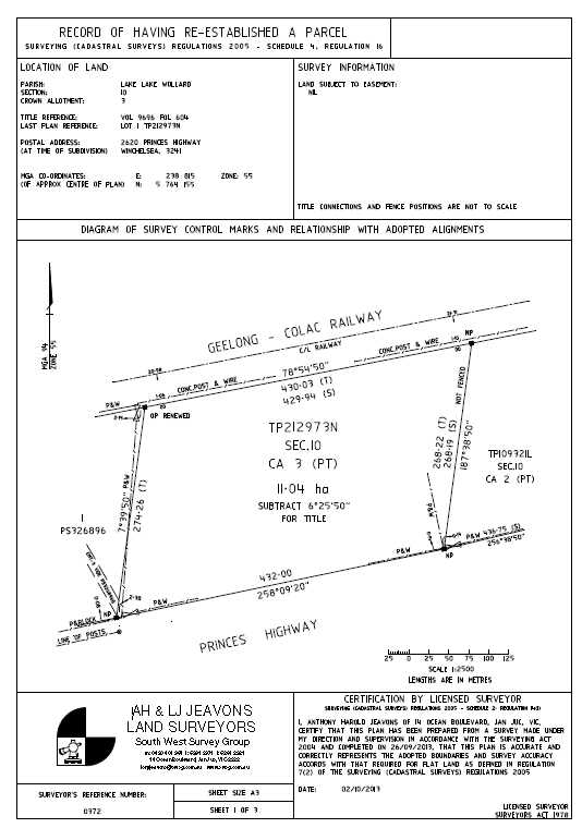
Rural Re-establishment
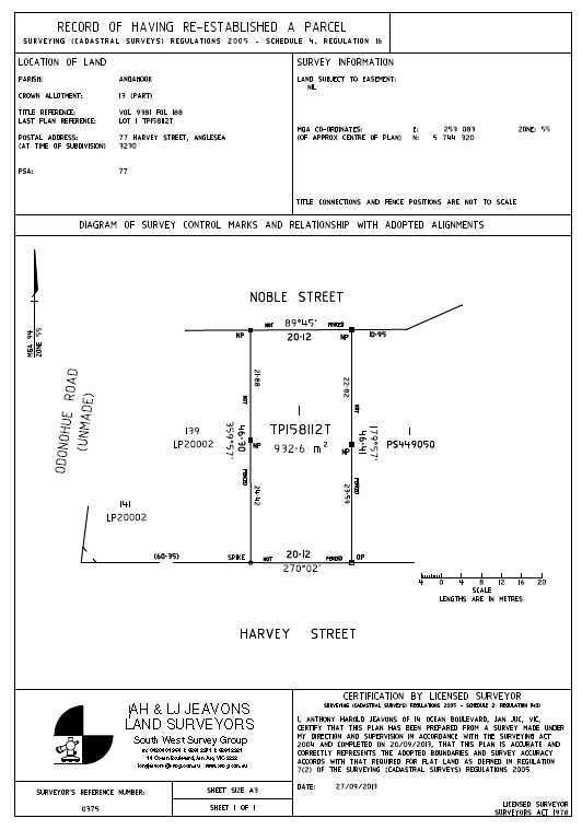
Urban Re-establishment
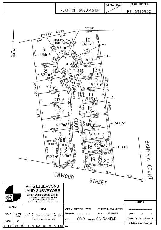
Multi Lot Subdivision
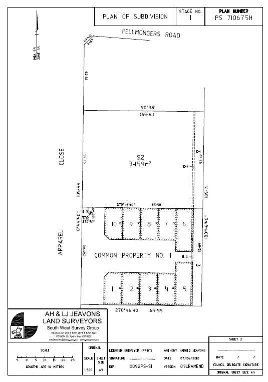
Staged Building Subdivision
1 Comment
Hi, this is a comment.
To get started with moderating, editing, and deleting comments, please visit the Comments screen in the dashboard.
Commenter avatars come from Gravatar.